
Shorezone Underwater Photography
Meet TRPA Shorezone compliance with site specific high resolution underwater photography.
Bird’s Eye Benefits
Specializing in a wide range of commercial and public sector projects.

FAA PART 107 COMMERCIAL CERTIFIED
In order to commercially fly drones under the FAA‘s Small UAS Rule (Part 107), we are Remote Pilot Licensed from the FAA.
More than a Pretty Picture
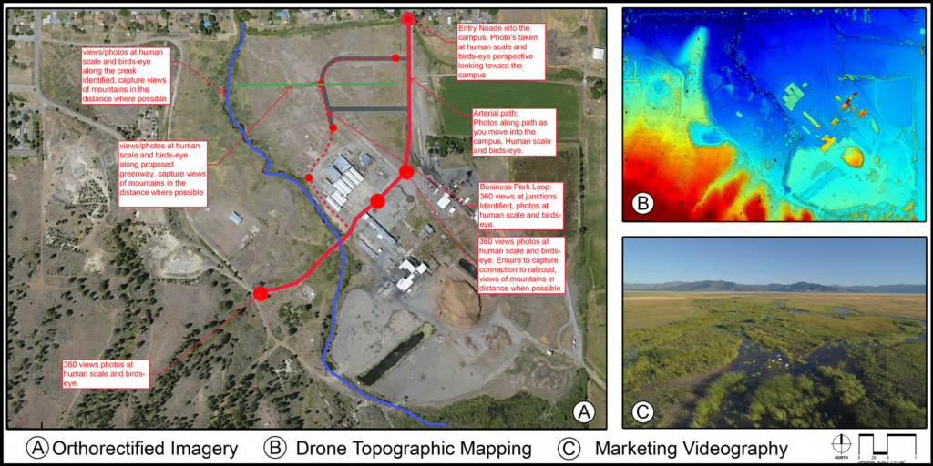
Photogrammetry can stitch together feet, acres or miles of photography into one seamlessly projected and orthorectified image. These images, along with stereographically processed 3D data can be used to create 3D models or calculate accurate volumes, elevations or measurements.
Ortho Mapping
Photogrammetry uses stereo imagery collected along a flight path. The imagery is processed to produce digital elevation data and orthomosaics that have been geometrically corrected so that the resulting image has the geometric integrity of a map and produces reliable measurements in GIS or CAD applications.
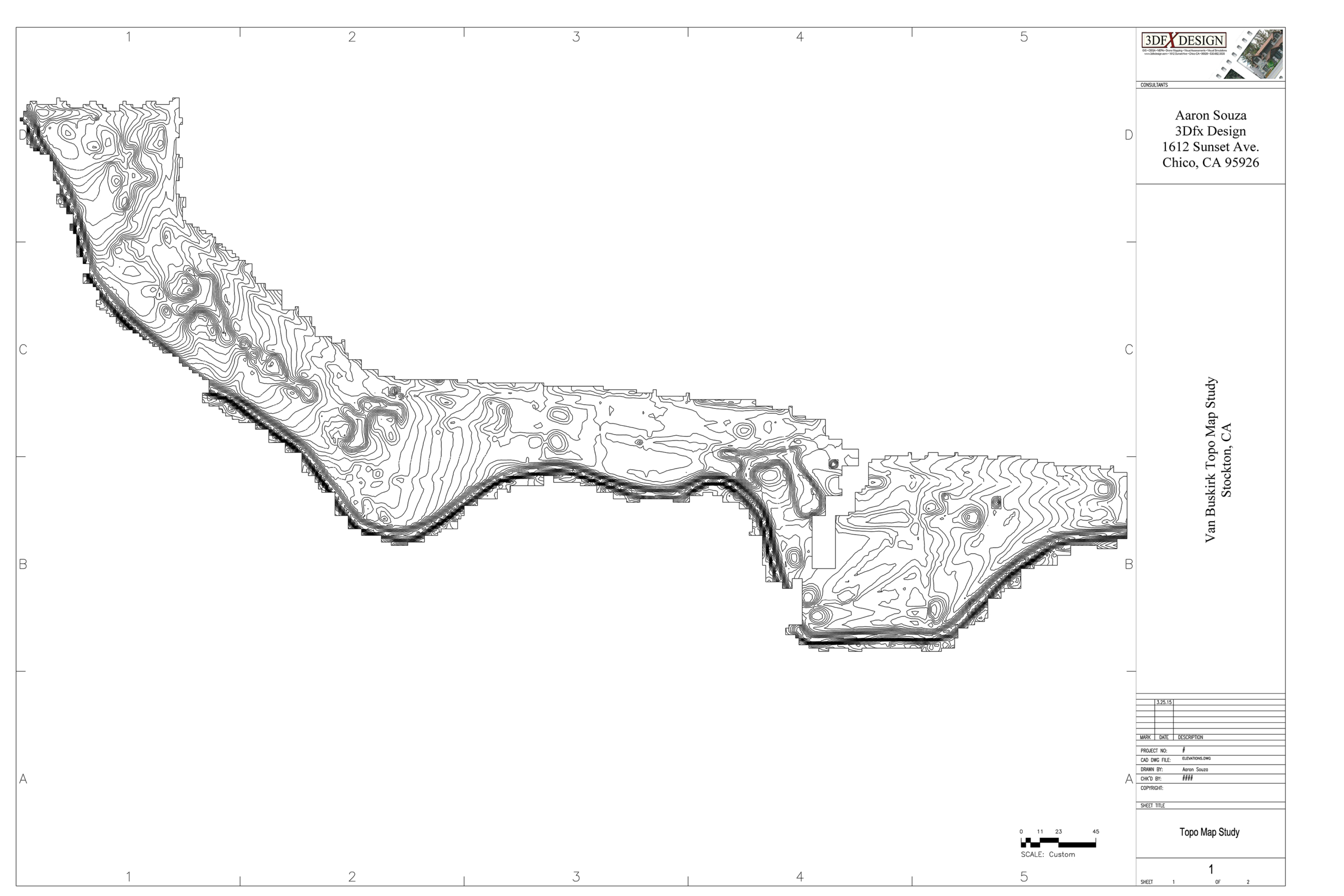
Topographical Design Mapping
Topographical characteristics can be identified in the initial design and planning stages.