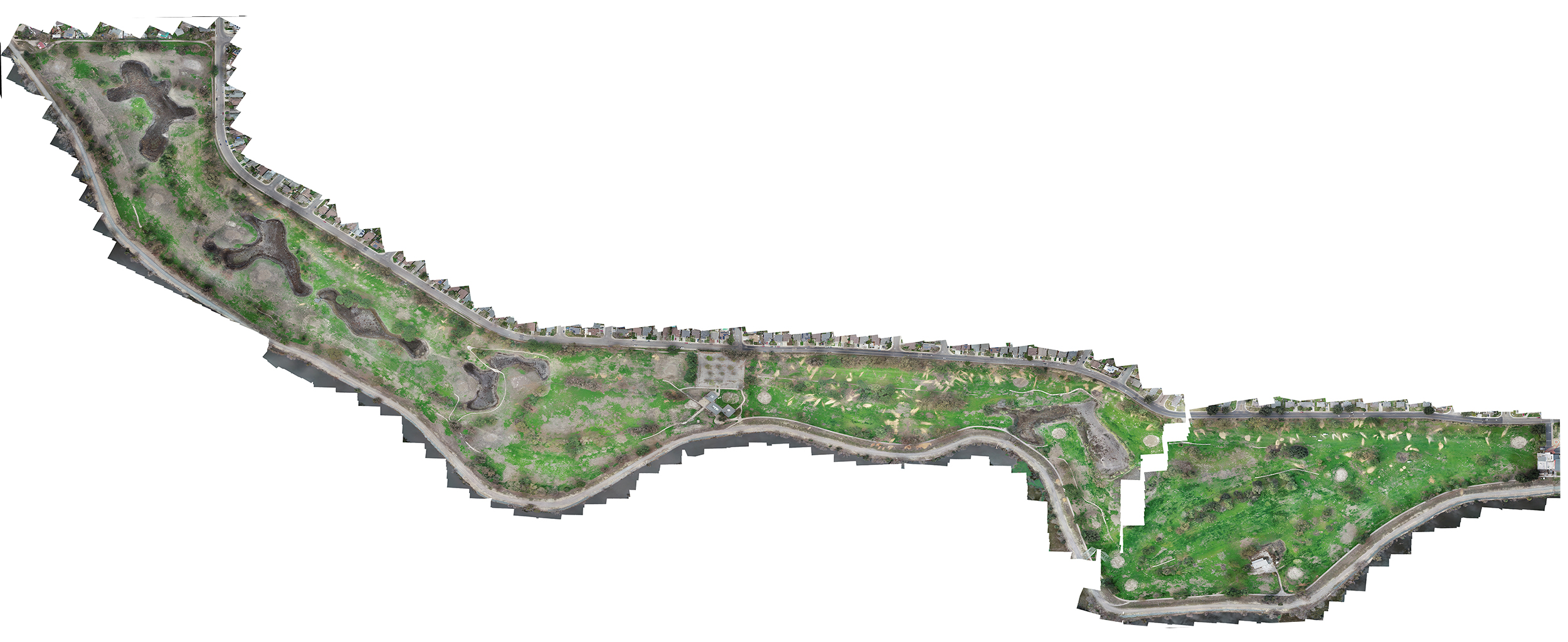
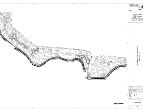
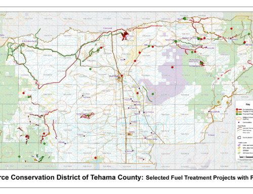
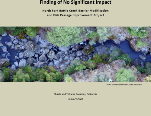
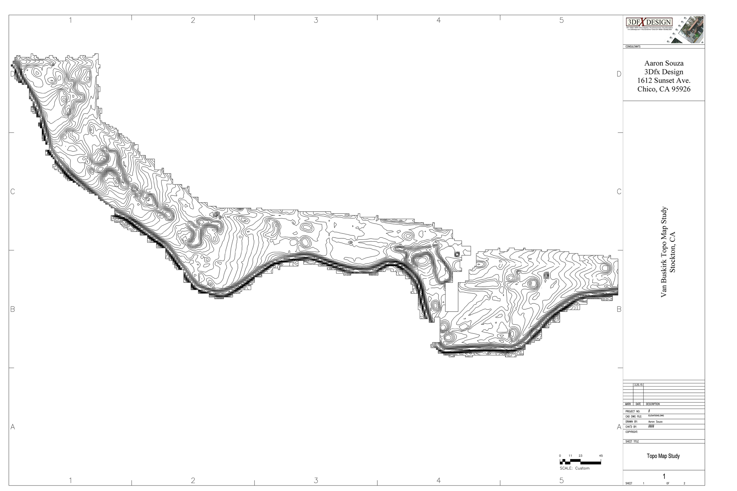
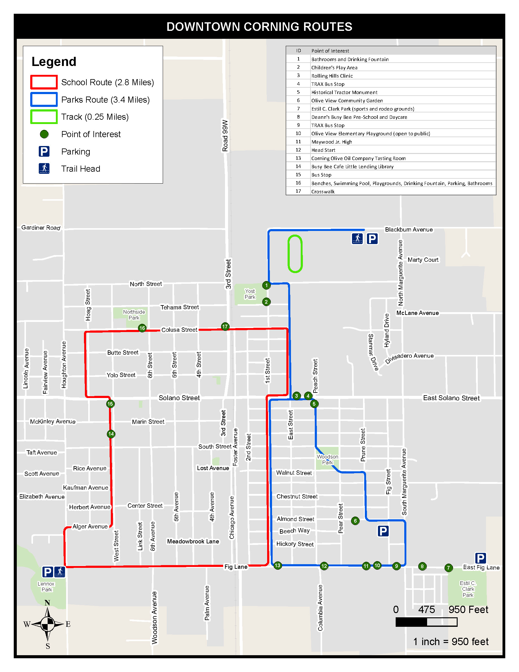
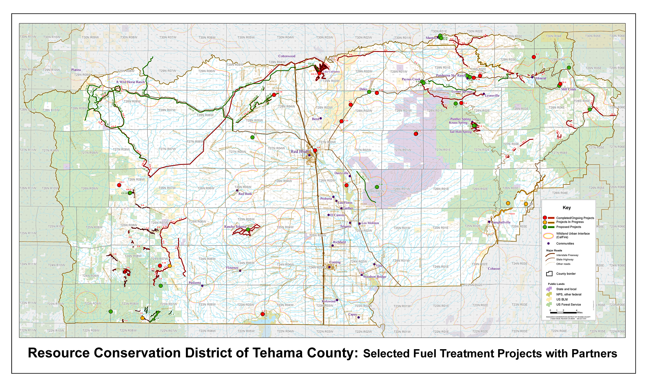
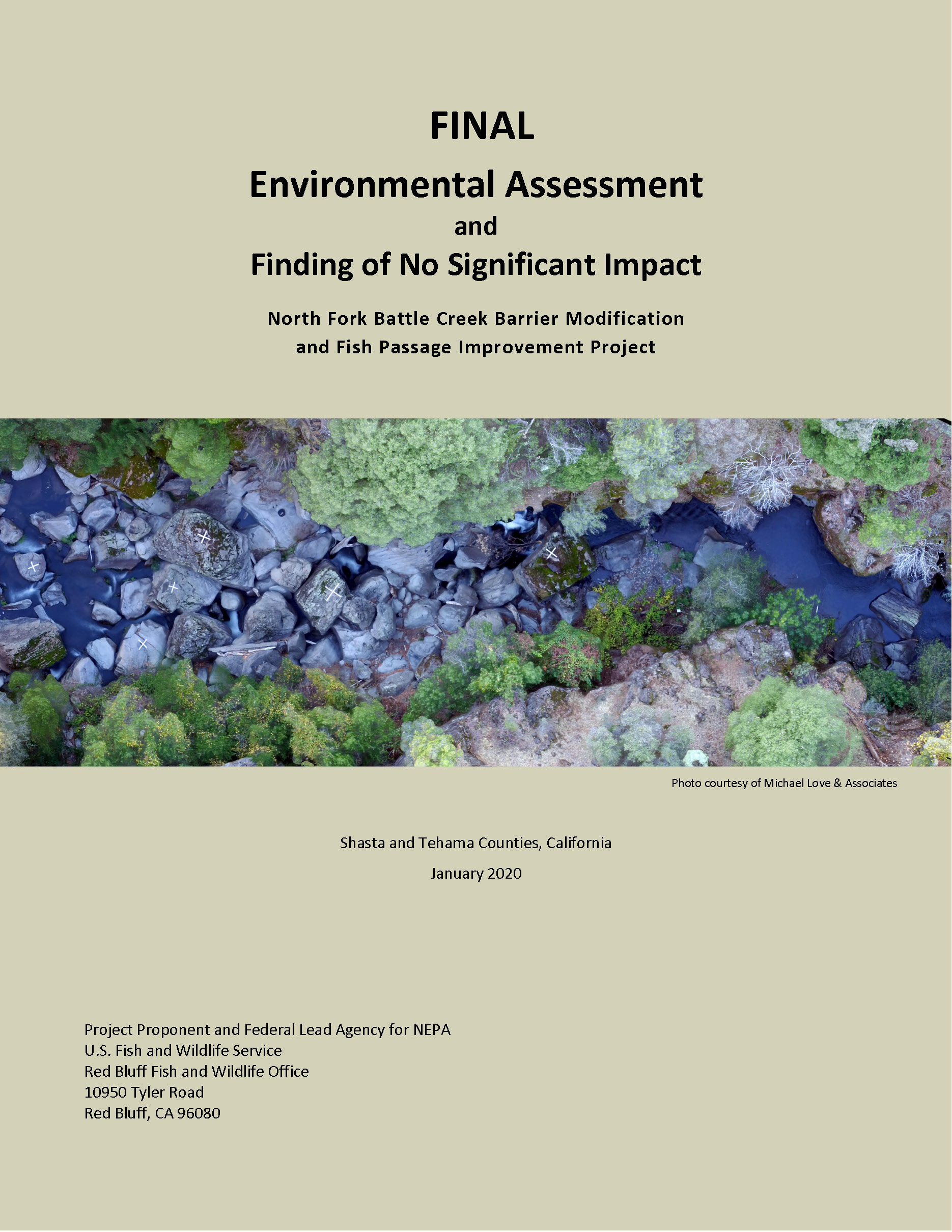
Stockton Drone Mappingadmin2021-09-06T21:31:51+00:00 Project DetailsCLIENTDesign Workshop PROJECT TYPEPublic Sector SERVICESDrone Photogrammetry LOCATIONStockton Ca Project Description Photogrammetry for a 160 acre city golf course being converted over to a park. Related Projects Topographical Mapping Study Gallery Topographical Mapping Study July 29th, 2021 | 0 Comments Walkability/Bikeability Maps Gallery Walkability/Bikeability Maps July 9th, 2021 | 0 Comments Esplanade Corridor Project VIA Gallery Esplanade Corridor Project VIA July 8th, 2021 RCDTC Fuel Treatment Project Gallery RCDTC Fuel Treatment Project July 8th, 2021 | 0 Comments Battle Creek NEPA Gallery Battle Creek NEPA July 8th, 2021 | 0 Comments